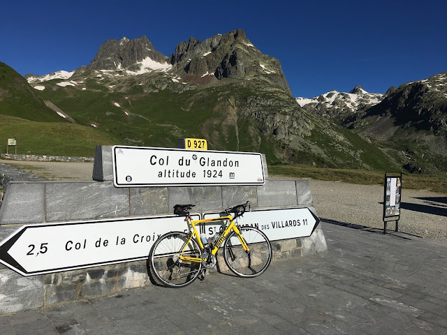
By 6:30 I'm heading out into a chilly but fine morning. My plan is to try and climb the Glandon before the heat starts to build. The first few miles up the valley to Allemond are cold and my rain jacket and fingerless gloves aren't quite enough. Once I get onto the climb my shivering soon subsides and I can enjoy having one of cycling's most famous cols more or less to myself. At this time in the morning there aren't many people around and the few vehicles that pass give me plenty of space.
I'm slightly unsure about how my legs will cope with a big ride. I've only managed three substantial rides this year and two of those were off road. With a lot less miles than normal in my legs I take it steady on the first climb. The majority of the climbing comes in the second half of the ride so it's easy to forget that the Col du Glandon is a 24km climb which tops out at almost 2000m. It's such a long climb that I welcome the unexpected descent half way up, a good way to tick off a couple of easy kilometres.
 |
| Looking back down the valley towards Allemond from the Lac du Grand Maision |
As I break into the sun towards the top the scenery changes. I've left the confines of the valley to emerge into a alpine meadow straight out of a film. I'm lucky enough to see a golden eagle circling high above and a marmotte in the meadow alongside me. What a wonderful place to ride.
 |
| Looking downhill at the start of the alpine meadow on the Col du Glandon |
After a quick stop at the top to put my jacket back on I set off down the descent to Saint Etienne de Cuines. It starts off very technical with tight hairpins and lots of gravel on the road. Aware of my relative isolation I take it easy at first but the further I descend the faster and more flowing the road becomes. This side of the Glandon is frequently climbed in the Tour and was the scene of Armstrong's famous bluff which was followed by 'that look' on the slopes of L'Alpe d'Huez.
The Maurienne valley is initially scenic but I'm soon in amongst the industry it is known for. The surrounding hydro-electic schemes provide the power required for the multitude of aluminium smelters and chemical plants. I'm struggling to follow the route, the GPX file I downloaded seems to just be a straight line down the valley and constantly tries to take me onto the autoroute. After an unplanned detour through the center of Saint Jean de Maurienne I decide it's time for the first cafe stop of the day.
The roadside bar I stop in has wifi so I'm able to sort out my route to Saint Michel de Maurienne. I enjoy a coffee and read the paper to catch up on the previous day's Tour stage. While I'm inside someone flicks a switch on the weather, I step outside into a wall of heat. It's almost 10 degrees warmer than it was half an hour ago.
The next section is straightforward. A friendly local falls in with me and we talk for a while but he's a bit too strong for me today and I let him ride on. From Saint Michel de Maurienne almost 2000m of climbing awaits in the space of 35 kilometers, quite a thought. I spin up easily, taking advantage of the low gearing fitted to my hire bike. There is barely a cloud in the sky and the sun beats down ferociously, almost directly overhead. There isn't much shade but I greedily ride through every patch I can find feeling grateful for the respite it offers.
Close to the top the view opens up and I stop to take a photo, the first time I've stopped climbing in over an hour. I felt fine when I was riding but I get a shock when I stop, my legs are fine but I feel light headed and a bit dizzy. Luckily I'm soon at the top of the Télégraphe where I had planned to stop for lunch.
 |
| Not too shaky! |
I pick a table in the shade and enjoy a massive baguette followed by apple tart and a coffee. I'm probably at the furthest point from home and I still have well over 1000m of climbing to get over the Col du Galibier. I need a plan to make sure I keep this ride enjoyable. Right now it consists of eating lots and trying to cool down. I accept that I'll need to ignore my ego and ride as easily as I can over the Galibier and take regular stops to cool down. The temperature is well into the 30s and I'm struggling with it more than usual today.
Refuelled and rejuvenated it's time for the fun descent to Valloire. After only a few minutes I've reached the ramp at the start of the Galibier. For the next 18 kilometers the road climbs with absolutely no shade. The scenery is spectacular and the traffic is very light. I'm riding well within myself but the heat is overwhelming. I stop at an abandoned building and drink in the spectacular view hidden for a few minutes from the sun. A group of cyclists see me and do the same. From here to the top I'm continually yo-yo'ing riders as we stop in what little shade we can find.
 |
| Spectacular views on the Col du Galibier |
 |
| The only shade for miles but what a view, spot the parked cars for a sense of scale. |
 |
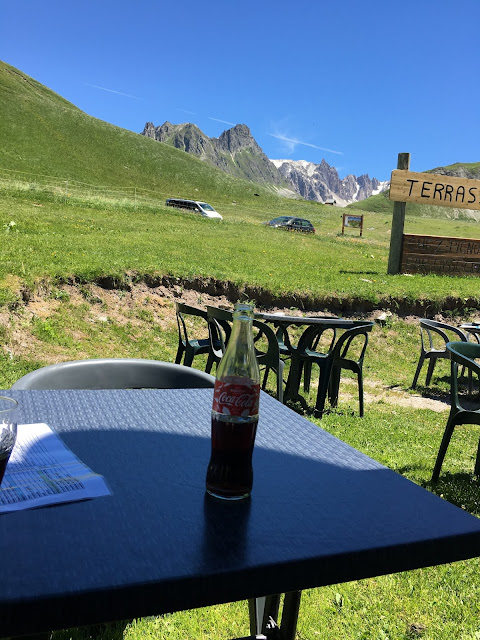
| A coke with a view |
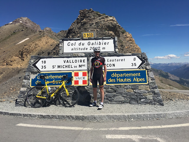
I'm happy to reach the cafe at Plan Lachet and stop for a well deserved coke, my third cafe stop of the ride. The final 8 kilometers from Plan Lachet to the top are considerably steeper but suit me better. I'm gaining height more quickly and the steep ramps and constant changes of direction are easier mentally than the unrelenting straight ramp on the first part of the climb. The scenery just gets better and better as I climb into the high mountains. I have to stop a couple of times to cool down, once in a culvert where a stream runs under the road and then in the tiny slither of shade offered by a parked car. A final steep section and I reach the top at 2642m.
 |
| Hiding in a culvert above Plan Lachet |
 |
| Almost there |
I can't really say I climbed the Galibier, I simply made it to the top. I try my best to appreciate the view before tackling the descent. It's incredible. 8 kilometres of sweeping bends take me to the Col du Latauret, passing motorbikes and cars along the way. A cafe stop for a quick espresso and I'm back on the road. 50 kilometers separate me from Bourg d'Oisans but I've got almost 1300m of elevation to lose, hopefully the engineers who built the road used it well.
 |
| The descent from the Col du Galbier is pretty special |
 |
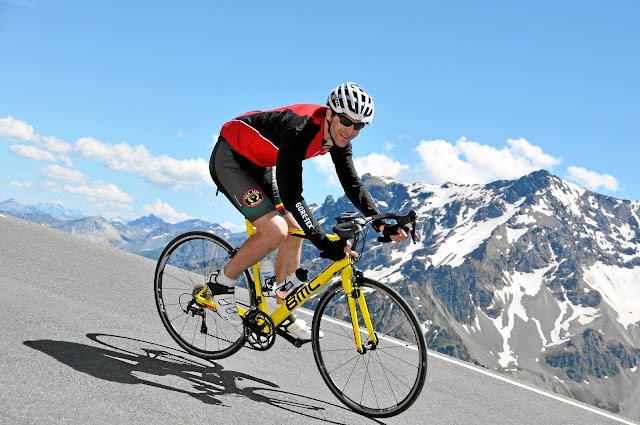
| Who knew the B in BMC stood for banana. |
The first 20km are unbelievable, the descent is super-fast and so much fun that I've already forgotten the suffering on the last climb. The main road past the Lac du Chambon has been closed for over a year because of a massive landslide and I'm re-directed onto a bizarre temporary road that has been bulldozed along the other side of the lake. The next part of the descent is brilliant but it's obvious that I'm losing height too fast. A short climb followed a draining headwind section provide an appropriate sting in the tail.
I arrive in Bourg d'Oisan and find my waiting family just about to go for an ice cream, perfect timing. I haven't returned my bike yet so I'm claiming it, a 5 cafe stop ride!


1 comment:
nice place for it .
Post a Comment